On Sunday, Dec. 8, 2019, I was able to tick Mt. Pulag off my bucket list and conquered the majestic mountain together with my friends Weng and Mayette and nine others who were a mix of beginners and experienced mountaineers.
Basic facts
Mt. Pulag via Ambangeg trail
Bokod, Benguet
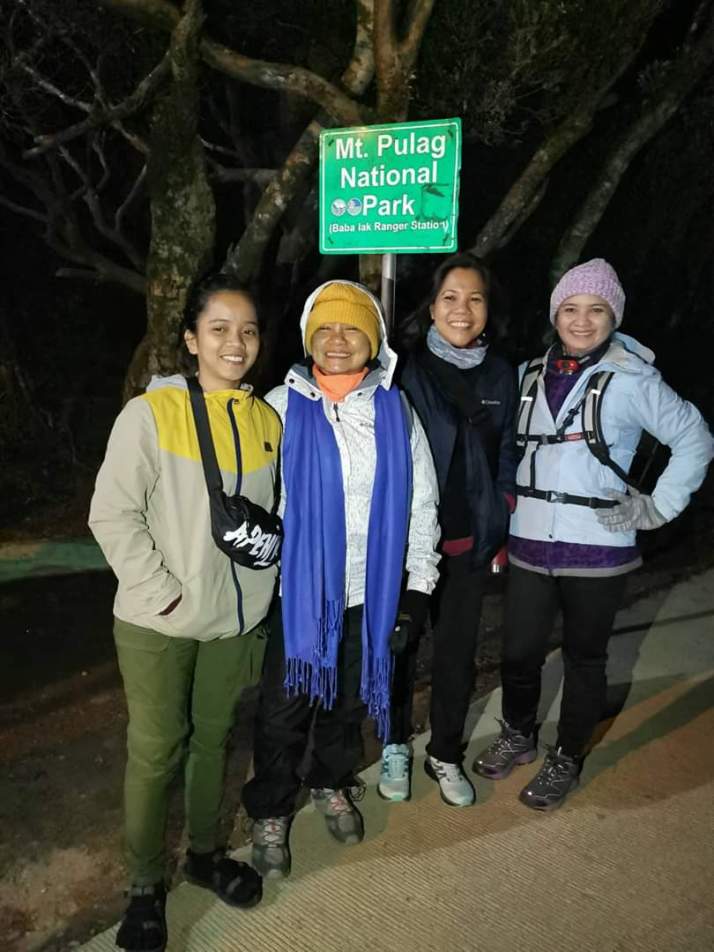
Major jump-off: Ambangeg Ranger Station, Bokod, Benguet
LLA: 16°34’58″N 120°53’15″E, 2922 MASL (#3)
Days required/hours to summit: 1 to 2 days/4 to 5 hours
Specifications: Major climb, difficulty 3/9, trail class 1 to 2
Trail system: Grand Cordillera Trail, Section 3
Features: Sea of clouds, dwarf bamboo slopes, pine forest, mossy forest
Mt. Pulag is popular among hikers and trekkers not only of its fabled views and breathtaking sea of clouds but also of its elevation, being the highest peak in Luzon and the third highest peak in the Philippines next to Mt. Apo and Mt. Dulang-Dulang, both in Mindanao.
The mountain stands high up at 2926 meters above sea level and near the heavens that the tribes who live in and around it believe they can commune with the gods, and for them, climbing is a sacred activity. Dubbed “playground of the gods” with its summit reaching the sky and jutting through the clouds, it’s the closest thing to heaven.
There are several trails that lead to Mt. Pulag: the easy Ambangeg in Bokod, the challenging Akiki in Kabayan, the arduous Ambaguio in Nueva Vizcaya, and the alternative trails Eddet and Tawangan, both in Kabayan, Benguet. We chose to trek the Ambangeg trail, the shortest and the relatively easy trail compared with the others.
Going to Benguet
We hired a tour organizer for this Mt. Pulag adventure. Mayette, Weng, and I were joined by nine other trekkers in this tour. Our tour organizer Gala Eyranians made the transporation arrangement that took us from Greenfields City to our homestay in Benguet for which we stayed overnight to rest before the climb the next day and vice versa.
We left Greenfields City around 11:30 pm on Friday, Dec. 6, and arrived in Benguet around 6:00 a.m., Dec. 7, where we had breakfast in a local eatery there and then waited for the time the DENR office to open for the registration and mandatory pre-climb orientation. The orientation was done in batches of at least 80 to 90 people at a time. We were the fourth batch, so we took the spare time taking pictures, goofing around, checking out souvenir items, and eating strawberry taho! The orientation was short yet very comprehensive and informative.
Once the orientation was done, we were taken to the Ranger Station, the jump-off point, to register yet again and then have our lunch in one of the eateries there before we were taken to our cozy though chilly homestay facing a vegetable farm at Baban’s. We checked in around 2:00 p.m. at Baban’s, took a few hours’ rest in our respective rooms, and then explored the vegetable farm through thick fog and biting cold.
I had been to Benguet once going to Sagada a few summers ago. It was cold back then, but I didn’t expect it to be so cold, maybe 5 degrees, at this time of the year! I had to wear layers of clothing, thick socks, a bonnet, and mittens just to keep myself warm or else I’ll turn into a human prune. It was so cold the tap water was even ice cold! You may need a heater if you can’t tolerate bathing in ice-cold water.
We had socials with the other guests/trekkers later that afternoon once rested at Baban’s and then had pork sinigang sa sampalok, rice noodles with vegetables, and red rice for dinner at around 7:00 p.m. Lights off was 8:00 p.m.
Wake up time was set at 12:00 midnight. We had a hot macaroni soup at around 1:45 a.m. before we headed to the Ranger Station to meet up with our guide at 2:00 a.m.
The hike/trek to Mt. Pulag is also scheduled as follows: 12:00, 12:30, 1:00, 1:30, 2:00, and 2:30. Our jump-off time from the Ranger Station was 2:30 a.m. To avoid overcrowding at the peaks, viewing points were assigned for each group to ensure that no one will miss the sea of clouds.
Way up to the sea of clouds and summit of Mt. Pulag via the Ambangeg trail
I’ll be describing the trail here as I saw it at daylight on our way back to the Ranger Station.
From the Ranger Station to the summit is around 8 km, so the whole trail in total is about 16 km. Depending on the pace, the summit can be reached in about 3 to 5 hours.
With only our headlamps to light our way, we started our trek in the biting cold and darkness as the half-moon hid its face behind the clouds, although the sky was blanketed with stars. We first went through wide trails surrounded by pine trees and picturesque landscape, a place they call “pine forest.”
After a few minutes’ to an hour’s hike, we entered the “mossy forest” that enchanted us with its grand spectrum of flora—pink flowers known locally as ayusep, red-leaf shrubs, ferns, and mossy trees. There were cold springs that we passed along the way where you could refill your water bottle should you need to. The water is ice-cold though.
About an hour or so of hiking, we arrived at Camp 1, marked by a hut, where we rested for a while and relieved ourselves in the latrines before hiking back up. Yes, there’s a latrine, but there’s only one for the male and one for the female so expect a long queue when you have to go.
After about 20 minutes at Camp 1, we started our trek to Camp 2. It took us about 2 hours to reach the camp where we again rested for a while. Once rehydrated and rested, we began our trek to our assigned peak to wait for the sunrise and for the sea of clouds to appear.
We hiked through dwarf bamboo slopes and grassland going to our assigned peak. It was amazing to see bamboos just knee to thigh high along a stony path. What was also amazing is that the dwarf bamboos and pine trees don’t mix. You wouldn’t see any pine trees nor bamboos in the mossy forest. It seems that each has a place on its own.
We arrived at our viewing point as the sun was just rising in the horizon. It was a marvelous and stunning view of the sun above a sea of clouds! I couldn’t help but gasp in awe at God’s creation as I watched the sunrise breaking the horizon and the sea of clouds around me. It was spectacular to see distant peaks surging like islets in an ocean of cotton clouds. From our viewing point, we could see the golden brown peak of the majestic mountain, Mt. Pulag for “pul-ag,” which to the locals mean bald.
Although the Ambangeg trail was the easiest relative to the other trails, I was catching my breath as the air gets thinner and the temperature plummeted to near-freezing level as we went higher. It was warmer near the summit as the sun started to shine, so I took off one layer of clothing to make myself comfortable.
The entirety of the trek to the summit was grassland, although there’s only one moderately steep part. At around 7:00 a.m., more than 4 hours of walking from the Ranger Station (with rest and picture taking), we reached the summit of Mt. Pulag. Finally, we were standing on top of the highest peak in Luzon at 2926 meters above sea level!
The summit views of Mt. Pulag are fabled and legendary. On a blessed time, sea of clouds form beneath, covering everything but the highest points in the Cordilleras. Truly, we were blessed because we did not only reach the summit but also witness the elusive sea of clouds!
We trekked down around 8:00 a.m. after countless photos taken at the summit and reached the Ranger Station just around lunchtime.
I grope for words to describe my experience and feeling as I felt the sweet, cold embrace of Mt. Pulag. How beautiful is the sea of clouds exactly? How majestic is Mt. Pulag? It’s hard to put them into words. One has to go to Mt. Pulag in order to find out.
NOTES:
Mt. Pulag via Ambangeg itinerary
*We hired a tour organizer Gala Eyranians for this hike to arrange our transportation, accommodation, meals, and registration. You may contact the organizer Ms. Lans at 09122075691 or check out their FB page Gala Eyranians to book a tour package.
Day 0, Dec. 6
2200 Meetup at McDo Greenfields
2300 EDT Take van to Bokod, Benguet
Day 1, Dec. 7
0600 ETA Bokod, Benguet. Breakfast and rest.
0800 ETA DENR Center for registration and orientation.
1130 Set out for Ranger Station.
1200 ETA and lunch at Ranger Station.
1330 Check in at Baban’s Homestay. Rest. Socials.
1900 Dinner.
2000 Lights off.
Day 2, Dec. 8
0000 Wake up call.
0130 Breakfast.
0200 Meetup with guide at Ranger Station.
0230 Start trek from Ranger Station.
0530 ETA Sea of clouds viewing spot.
0730 ETA Summit.
0800 Start descent to Ranger Station.
1100 Back to Ranger Station. Buy souvenirs.
1230 Lunch at Baban’s. Washup. Prepare for check out.
1400 Check out at Baban’s.
1430 Log out at DENR Visitor Center. Head for Baguio City
1600 ETA Baguio City. Buy pasalubong.
1630 Head back to Manila.
1930 ETA Pangasinan. Dinner.
1200 Back in Manila.
Estimated budget for organized tour: 2800 to 3300, usually with inclusions of 3 meals (dinner, breakfast, and lunch), homestay, transportation fee (van), guide fee, and other fees. Organized tour package inclusions vary as well as price range.
ADDITIONAL NOTES:
Scheduling. Mt. Pulag is accessible throughout the year, but it is advisable to climb it during the early months of the year, December to early May, during the non-rainy months. The rainy season, especially during bad weather, may not allow transportation to reach the Ranger Station. It could also get very cold and camping may not be suitable. It is also best to hire a tour organizer for convenience (transportation and other arrangements). For DIYs, it is advisable to contact the DENR office for scheduling and assignment of trek guide because no one is allowed to climb Mt. Pulag unscheduled and without a guide.
Facilities. There are latrines in the camps and shower in the Ranger Station. Water sources can be found in the mossy forest should you need a water refill during the trek. Cellphone signal exists in many parts of the trail, including the Ranger Station, the campsite, and the summit. Tents (limited availability) and trekking poles may be rented or bought from the park. Gloves, bonnet, hiking pants and shirts, or jacket may be bought at some stalls in the park.
REMINDERS
Pack lightly but be sure to bring a headlamp or flashlight, thick clothes, jacket, socks, gloves, scarf, bonnet or cap, and a rain jacket in case it rains. Wear appropriate footwear that will keep your feet protected from cold and other elements and layer clothing to keep you warm as it gets really cold when temperature drops to as low as 5 to 0 degrees up in the mountains during the trek. Trail food and water is must. Secure money and cellphone in a ziplock to keep them dry, bring an ID with you, and stay with your group during the hike.